Mapping your watershed
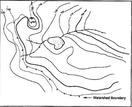
To begin mapping your watershed, first collect all of the materials you will need. A pencil and a topographical map are very helpful. Topographical maps display physical features of the land such as hills, valleys, ridges and channels. A map can be obtained through your local USGS (US Geological Survey), a map store, or from your local conservancy. The lines on a "topo" map represent the altitude of that area. Closely spaced lines indicate rapid changes or steep slopes while widely spaced lines represent gradual changes.
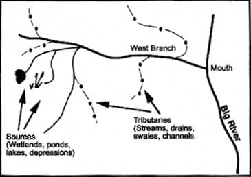
1) Use a topographic map to locate the river, lake, stream, wetland, or other waterbodies of interest.
2) Trace the watercourse from its source to its mouth, including the tributaries. This step determines the general beginning and ending boundaries.
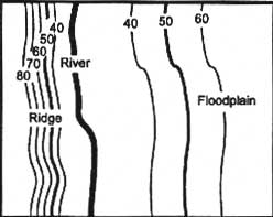
3) The lines on the map are known as contour lines. Contour lines connect all points of equal elevation above or below a known reference elevation. The numbers beside the lines indicate the elevation. Thin lines mark 10 foot intervals in elevation, while thick lines mark 50 foot intervals in elevatioon.
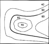
Contour lines that are spaced far apart indicate that the land is gently sloped and more level. Closely spaced lines, however, indicate steep changes in elevation over a short distance.
For the following steps go here.